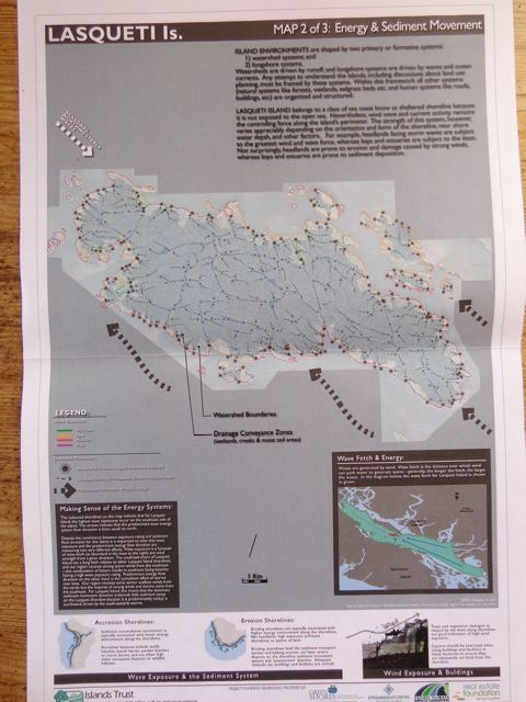
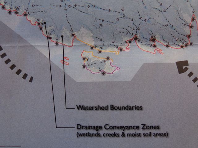
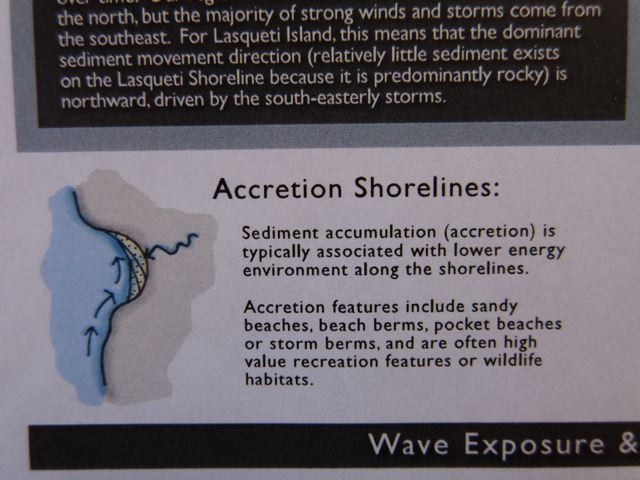
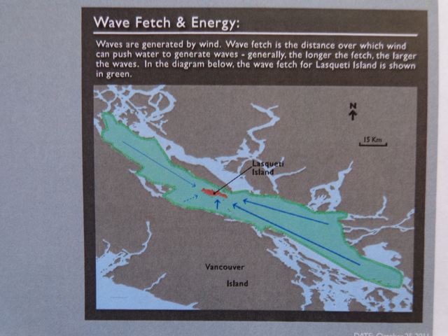
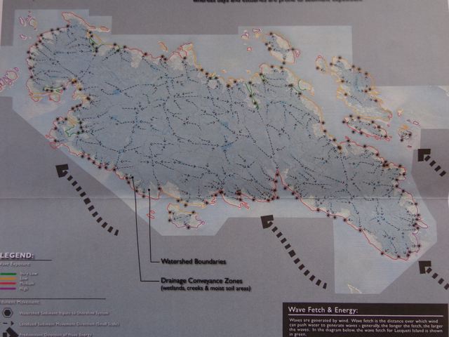
Shoreline Map 2 - Energy & Sediment Movement
Here are photos of map 2
| Attachment | Size |
|---|---|
| dsc00450.jpg | 68.83 KB |
| dsc00451.jpg | 59.52 KB |
| dsc00452.jpg | 66.52 KB |
| dsc00454.jpg | 62.22 KB |
| dsc00455.jpg | 46.87 KB |
| dsc00456.jpg | 59.51 KB |
Here are photos of map 2
| Attachment | Size |
|---|---|
| dsc00450.jpg | 68.83 KB |
| dsc00451.jpg | 59.52 KB |
| dsc00452.jpg | 66.52 KB |
| dsc00454.jpg | 62.22 KB |
| dsc00455.jpg | 46.87 KB |
| dsc00456.jpg | 59.51 KB |
 Copyright © 2006 - 2026 Lasqueti Internet Access Society
Comments
Full Resolution Map
The full resolution map as a PDF can be downloaded from the Island Trust - http://www.islandstrust.bc.ca/ltc/la/pdf/lasquetishorelinemapping.pdf
Post new comment