Shoreline Map 1 - Distribution of Shoreline Types
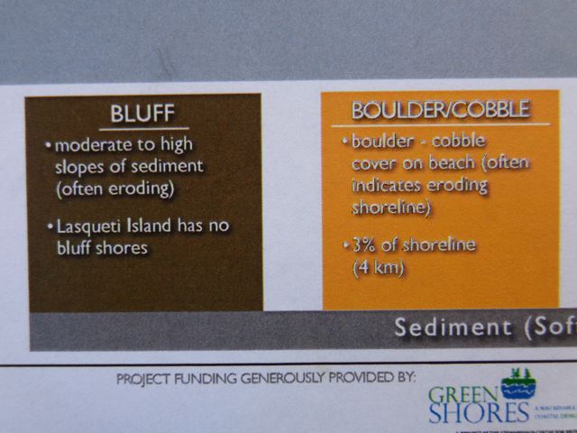
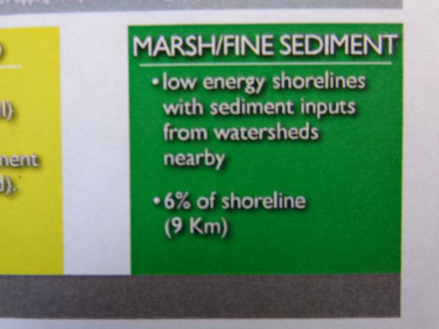
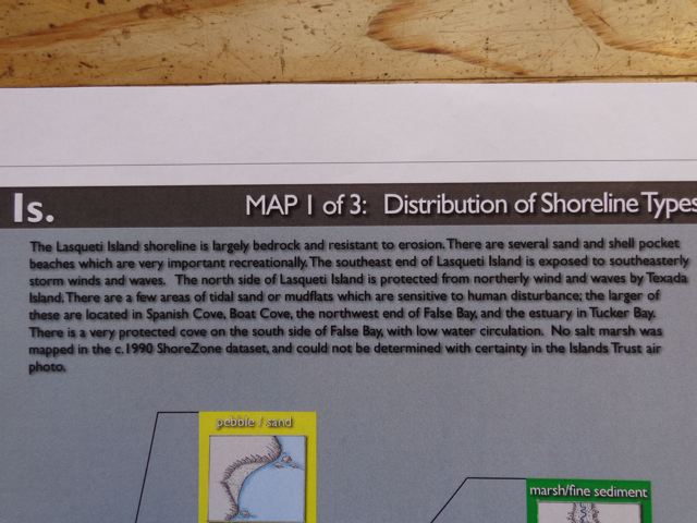
Here are photos of the first of three maps of the Lasqueti shoreline to be shown and explained at the workshop at the Arts Centre on Thursday. Everyone welcome
| Attachment | Size |
|---|---|
| dsc00437.jpg | 64.15 KB |
| dsc00440.jpg | 62.2 KB |
| dsc00441.jpg | 46.81 KB |
| dsc00442.jpg | 54.69 KB |
| dsc00443.jpg | 54.69 KB |
| dsc00444.jpg | 58.57 KB |
| dsc00445.jpg | 63.17 KB |
| dsc00446.jpg | 67.71 KB |
| dsc00447.jpg | 61.24 KB |
| dsc00448.jpg | 47.78 KB |
| dsc00449.jpg | 63.35 KB |

Comments
Full Resolution Map
The full resolution map as a PDF can be downloaded from the Island Trust - http://www.islandstrust.bc.ca/ltc/la/pdf/lasquetishorelinemapping.pdf
Post new comment